by Asif Alam Mazumder and Harshal Khade
Photo Credits: Mohan Dhuldhar
The monsoon is in full swing. Kharif crops are sown. While rainfall nurtures the crops, it is important to replenish groundwater and conserve it for the rabi season too. Proper watershed interventions ensure excess rainwater is channelised and conserved, even in times of recurring extreme weather events and climate variability. A key intervention in ridge-to-valley watershed management is a Continuous Contour Trench or CCT.

CCT in watershed management
In watershed management, conservation, regeneration and judicious use of all natural resources – land, water, vegetation, animals and humans – within a watershed, brings about an equilibrium in the ecospace where there is equity in sustainable use of resources.
Watershed development in practice, is a scientific approach comprising many measures, that helps in retaining soil moisture and water conservation. Continuous Contour Trenches (CCTs) are one of the crucial area treatments in this approach.
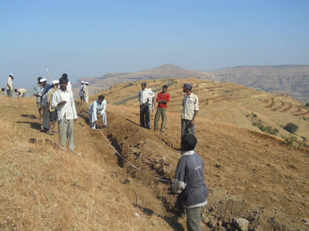
A Continuous Contour Trench is dug at a right angle to the slope. Continuous trenches are planned along contour lines so that water flowing downhill is stopped in its tracks by the trenches, and water percolation into the soil below is facilitated. The excavated soil after digging the trench is used to plant grass, legumes and the like. This will stabilise the soil around the trenches. The roots and foliage of the vegetation will help trap sediment that would overflow from the trench during heavy rainfall.
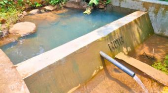
The water that percolates through the trenches provides soil moisture, for crops cultivated after rainfall, and perhaps extending even to the dry season. It can be directly pumped out for irrigation or extracted from shallow wells in the area.

Marking contour lines using a hydro-marker is an important step before digging CCTs. On different points along the contour line, the level in the hydro-marker shall be consistent. This is to ensure the pressure of flowing water will be equally distributed over the structures and is sustainable in the long run.

CCT is the best suitable technique for soil, water and forest conservation in regions with low rainfall and the terrain is especially hilly held together by rocky outcrops and such geographical features.
Trenches are dug in line with the topographic contours. Distance between two trenches depends upon the slope.
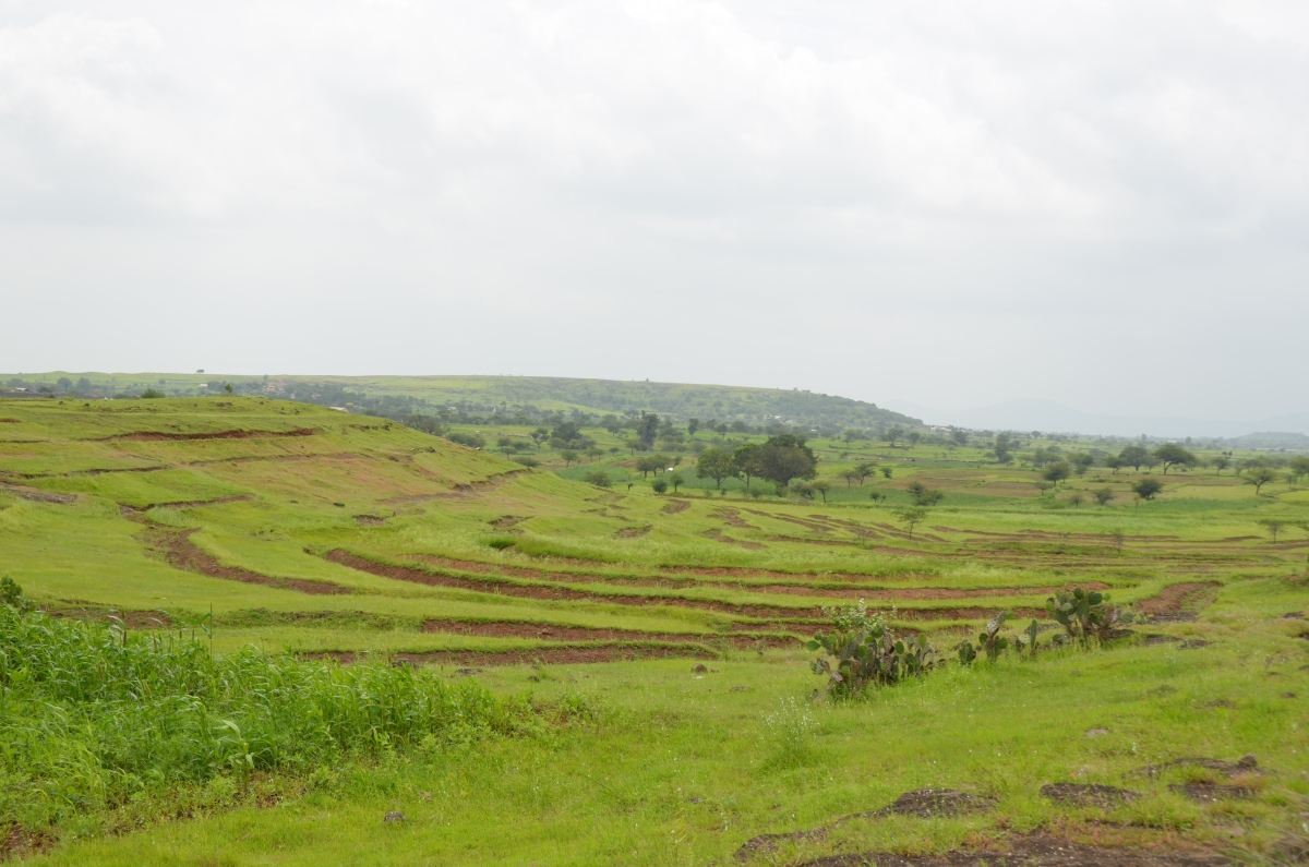
CCTs are employed to stop the loss of soil and reduce the rate of water runoff, resulting in increased water percolation. This recharges groundwater as well as the green cover in the area besides improving soil quality thereby reviving degraded lands.

CCTs improve agricultural productivity and grazing potential as well as water for livestock and help in drought mitigation.
While CCTs arrest flooding and capture water from floods, in case of excessive rainfall, the vegetation along the outer edge of the contours will stabilise the trenches and prevent erosion.


There exists a vicious cycle in a degraded landscape. As there is little or no tree cover, there is loss of topsoil due to erosion. Rainwater is not able to percolate underground and flows into the streams. Ridge to valley watershed management breaks this vicious cycle by soil and water conservation measures such as CCTs appropriate for specific landscapes.
Watershed management starts from the ridge and progresses downwards further into the valley as measures such as Continuous Contour Trenches help in arresting the water flow.