
By Dr. Taufique Warsi and Dr. Eshwer Kale
Groundwater resources, considered a replenishable resource, are often overexploited to meet the growing demand of agriculture, domestic, industrial purposes, and inhabitants. Its depletion has hugely affected the economic and social sector, forcing farmers in Maharashtra to construct new wells. However, the support the farmers seek from government schemes/ subsidies is not forthcoming putting more pressure on farmer’s pockets. According to the Groundwater resource Estimation Committee (GEC) study, it suggests that if the slope of mountain or hilly terrain is greater than 20%, then it will be excluded because these are not likely to contribute to groundwater recharge. Before making any intervention or estimation in the hilly terrain, utmost care must be taken and thoroughly understood before making any remarks.
Historical background
Sahayadri hill ranges are flourished in Maharashtra, making them more attractive and welcoming. A century ago, all the administrative points belonged to the fort. The Maratha’s strength is closely associated with the forts and fortress; the range of fort and fortress itself acts as a natural army to prevent the invasion of foreign rulers. Ramsej is a prominent fort and historically rich; it experienced the war for almost six and a half years against Mughal Empire. The fort was built between the 9th and 11th centuries to collect taxes between Khandesh and Gujrat, according to research(2). The villages taken under study are clustered around the Ramsez fort, and the villagers believe that Lord Rama stayed in this fort during his exile.
Challenges
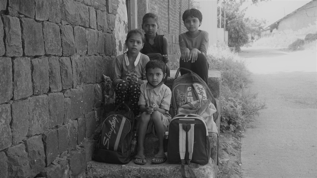
In the study area, most dug wells become dry with very few self- yielding wells. These wells then get filled by transferring water from the nearby river and stream through pumps. During the months of July and August, water appears in the stream and sustain up to November. However, water management committees in each village are responsible for drinking water supply in the area and do not meet the requirement except for one village (Manori). So people from many hamlets have to purchase clean water for drinking purpose, which cost them around Rs 900 per month in the dry period.
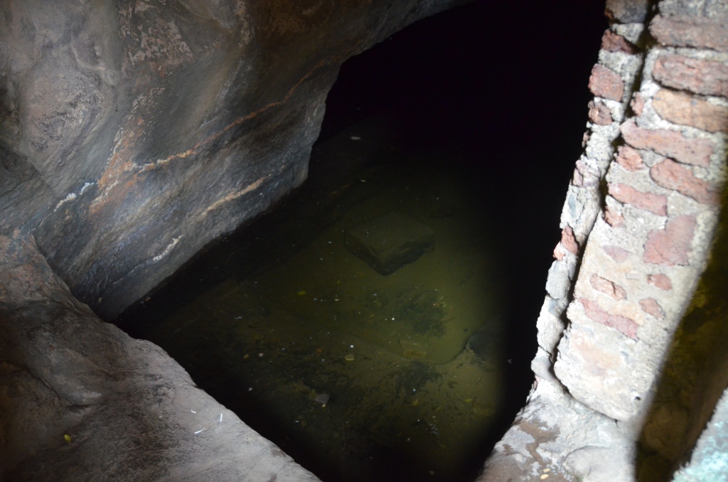
Apart from that, bore wells were counted in and around the research region, with the water level being intense and the average depth of a bore well being around 350-400 feet. Unfortunately, borewells don’t yield much water and are only sufficient for drinking, running for 15-20 minutes with a 2 to 5 hp pump. As a result, the villagers run out of water for 3-4 months (March-June) in a year, and farm ponds are being used to meet domestic and irrigation requirements. The dry spells create havoc amongst the local inhabitants, and the water supply through tankers pool their gaps for survival.
Field investigations
Before the field investigation, initial thematic layers were generated to understand the Geology, drainage network, watershed extension, and terrain complexities. Later, the WOTR team initiated the social survey to understand the actual ground reality and the concern associated with the locals regarding water. Subsequently, geological and hydrological well inventory investigations were taken up with a bottom to top approach. The hydrogeological team began their investigation by identifying the exposure and subsurface cross-cutting from the dug well to understand better the subsurface geological structure, which was difficult to extract water from. With a hawk’s eye perspective from the top, the survey began at the Ramsez fort to learn about the traditional strategy to survive in the past and to learn about the settlement around the fort.

Geological Perspective
The study area is dominated by vertical basaltic flows, which give rise to tabletop-looking topography, also known as a plateau. These individual flows are separated with the marker bed known as red bole or intertrappean. However, the area under study is not equipped with a healthy subsurface space to store and yield sufficient water. The team has identified some exposures and crosscutting, which show that the fractured zone and intertrappean beds are sporadic in the area, making the subsurface more resistive towards water transport.


Remarks
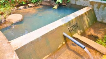
Farm ponds are very prominent in the villages to store surface water, especially in the upper catchment area of the lower order stream. However, as per the scenario in the above-said villages, the availability of space to hold water is minimal; in that case, either storage wells and structures should increase in density, or the existing wells could increase the space available to store and transport the maximum amount of water.
Artificial recharge plays a vital role to make an aquifer rebreathe and enhancing the potentiality of depleted one. Aquifier modification can increase the aquifer’s ability to transmit and store water and create artificial openings in existing wells using hydro-fracturing and borehole blasting. In addition, Managed Aquifer Recharge (MAR) can also be introduced by constructing the intentional structures without compromising the quality.
Watershed management is an effective and promising technique to improve the catchment comprehensively; hence, it is implemented in the study area by constructing suitable structures to enhance the recharge rate and reduce the runoff loss. Droughts, floods, and depletion of aquifers are not new, these have been experienced several times in the past, but people found their way out to cope with the water crisis. However, these events are becoming more frequent and intensified as we move up the stairs.
Acknowledgement
This study is being conducted by WOTR in collaboration with Godrej Agrovet Ltd., Global Agribusiness Action on Equitable Livelihoods (GAA-EL) at the World Business Council for Sustainable Development (WBCSD), and Alliance for Water Stewardship (AWS).
- Groundwater Resource Estimation Methodology – 2015. Report of the Ground Water Resource Estimation Committee (GEC-2015), Ministry of Water Resources, River Development & Ganga Rejuvenation, Government of India, New Delhi, October 2017, 137.
- Shriram Vaijapurkar, Study of Ancient Water Storage System on Forts in Nashik District of Maharashtra. National seminar on water & culture, Hampi, Bellary Dist. June 2007.


1 thought on “Digging deep in search of water”
Worth reading. This is really a great blog. It has been clearly mentioned the present scenario of the groundwater and future mitigation of basaltic terrain.