– Sarita Chemburkar
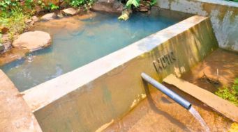
The natural world is an intricate and interconnected system where all things are interdependent, as noted by M. Kissinger. Each component plays a vital role in the food chain and in sustaining ecological equilibrium. Nonetheless, human activities such as deforestation, pollution, excessive use and depletion of water resources, intensive agriculture, and alterations in land use and cover patterns can significantly upset the delicate balance of ecosystem services, leading to adverse impacts on the environment, species, and human health.
Additional human activities that contribute to climate change, such as habitat destruction, pose a significant threat to the natural world. The degradation of habitats destroys the natural dwellings of plants and animals, ultimately leading to the loss of biodiversity and degradation of ecosystems (Laurance et al.). Moreover, climate change alters temperature and precipitation patterns, resulting in droughts, floods, and other extreme weather events that adversely affect the health of ecosystems and their inhabitants.
To minimize the detrimental impact of human activities on the natural world, safeguarding ecosystem health is imperative. Preserving the natural world and its resources for future generations is critical. Protecting forests and wildlife habitats, promoting sustainable farming practices, and reducing pollution are some of the measures we can take to ensure the long-term health of our planet. By being proactive in safeguarding our ecosystems, we can ensure the safety and well-being of all.
CoDriVE – A visualisation tool to protect natural ecosystems
Visualisation can be utilised as an important aid to help communities understand the importance of their natural ecosystems and take action to protect them for future generations. It can help communities become more aware of the state of their ecosystems and the impact of human activities on them.
Visualisation can also help communities identify changes in their ecosystem over time. This can include changes in land use, vegetation cover, or water availability. With this information, communities can take steps to address any negative changes and promote the restoration of the ecosystem. It can also help communities plan and make decisions related to the use of their natural resources. This can include deciding on the location of new infrastructure or the implementation of conservation practices.
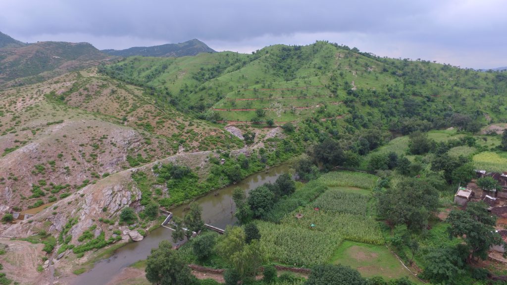
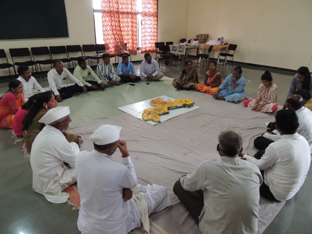
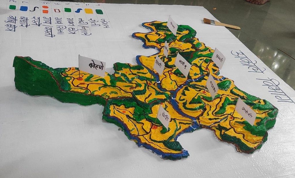
The CoDriVE – Visual Integrator 3D Surface Model is an innovative tool that empowers villagers to visualise their surface topography from a bird’s eye view perspective. Developed by WOTR and its research arm W-CReS (WOTR Centre for Resilience Studies), CoDriVE- Visual Integrator is a community-driven tool that enables people to visualise their environment and makes it easier to understand how it is changing over time. It also helps to articulate and visualise the changes in landscape and enables villagers to take necessary measures to preserve the health of ecosystems and maintain its sustainability.
CoDriVE – VI in Use
Recently, the CoDriVE tool was implemented in the Akole and Bhokardan blocks of Maharashtra, where inhabitants from nine and three villages respectively, took part in a workshop. Initially the facilitator sought the participants’ understanding about ecosystems in their villages. The participants recognised the ecosystems in their villages and the variety of services they provide that sustain farmers’ livelihoods.
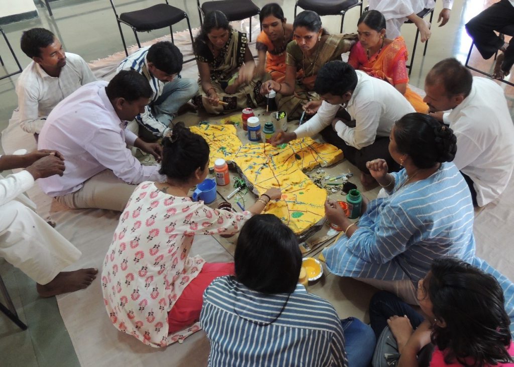
During the process of creating a surface 3D model and delineating different topographic features of their village, the participants were able to visualise changes in the landscape over the past few years. By utilising indigenous and local knowledge of communities regarding their natural resources, CoDriVE- VI adopts a participative visualization approach, which strengthens model-making techniques and provides grounded perspectives for the outcome of models.
Through this exercise, the participants gained an awareness of the harmful effects of human activities such as deforestation and land encroachment on the environment and on human health. Overuse of chemical fertilizers had resulted in soil and water quality deterioration. Furthermore, agriculture land was found to be expanding into grazing fields, while the number of wells and bore wells had increased, leading to depleting groundwater levels. Additionally, livestock numbers had declined due to land encroachment. If land surface temperature increased, evaporation and transpiration loss would also increase, potentially jeopardising water availability.
The utilization of the CoDriVE tool played a crucial role in aiding participants to understand the importance of preserving their ecosystem for the well-being of future generations.
It is essential to comprehend and safeguard ecosystems to ensure a healthy planet for all living beings. It is evident that the adverse impacts of climate change on ecosystem services will ultimately affect communities in the long run and CoDrive helps communities visualise this change and take appropriate measures for reviving and conserving their ecosystems.
In conclusion, the CoDriVE Visual Integrator 3D Surface Model has proven to be an effective tool in helping communities comprehend and visualize the significance of ecosystem services and their sustainability. It is crucial to conserve forests and other natural resources for future generations. By safeguarding our ecosystems, we can ensure a healthy planet for all living beings.